20250717 – McCarthy and the Kennecott Mine NHS

We camped by one of the old railroad bridges. The Kennecott company brought the supplies into the Kennecott mine and hauled the ore out. This campsite was about 10 miles in on the McCarthy Road. People talk about this road being extremely rough, but it seemed to be in fairly good condition. For anyone who has driven the Mojave Trail this one’s butter smooth.

I didn’t do as much research as I should have on McCarthy and the mine, so when we arrived, everything to the town is blocked off. I probably could have driven across the bridge that had a sign that stated “private no trespassing”, as it is owned by the town, since there is camping on the other side. But instead, I just opted for the $35 primitive campground that sits next to the glacier lake. It is definitely beautiful out here, with the Kennecott glacier and towering peaks in the background.

To get to the town there is a bus service, five dollars each way to get up to the Kennecott mine. Since you can’t drive in, and the walk is about 5 miles one way, a dollar a mile doesn’t seem to be that bad of a deal. Plus, dogs are allowed in the park, and in the town, and ride free on the bus, so we took them along.

I have wanted to visit this park for quite some time, and the Kennecott mine was the number one on my list. It is the most preserved early 1900s copper mine in the United States and in 1998 it was designated a national historic site. The town as well as the US government and some private entities are doing their best to rebuild and maintain the structures in this very harsh environment. The mine itself operated from the early 1900s until 1937 and produced $100 million in profits over that time. There is so much behind the mine that you can’t see, including the thousands of miles of tunnels that followed the veins through the mountain. It is truly impressive what humans can create. This is one of those typical mining towns where the company owned everything, and provided schools, recreation sites, stores, dining, and everything that miners would need to complete the difficult work that they signed up for.

Fortunately we didn’t have to walk the 10 miles, but the dogs were definitely pooped by the time we got back. Up at the mine there’s a creek that runs through the site that the pups had a chance to get some water and do a little swimming to cool off. It’s definitely not 110° like home, but it’s 78° and full sunshine, they can feel hot.

We decided to stop in town, the town of McCarthy, and have a beverage and some curly fries at a restaurant called The Potato. We continued on through town and checked out the Mercantile and viewed a couple of other restaurants. The old town is definitely quirky, beautiful, and falling apart in places. But more people are coming here and rebuilding and it’s kind of a neat place.

The campground is set at the end of the glacier. We were sitting on the shore watching the lake and heard rocks crumbling and falling into the lake. It’s definitely an interesting sound. After doing some research and reading a bunch of information about the glacier, it turns out all of those piles of dirt out there are actually remnants of the glacier they have melted, and are actually still part of the glacier. Underneath all that rock (debris carved for 10,000 years from the mountain) is still a big frozen hunk of ice. What we are seeing is the normal life of a glacier melting and falling into the lake. The lake actually drains off of one side into the river, which itself is impressive in size. I had looked into hiking to the glacier, but after watching all the people yesterday that we’re coming back, the 4 mile trek is very rough terrain, and definitely not suited for our pups. (People were coming back soiled up and returning clip on ice treads). The pups definitely didn’t like the bus ride, they certainly wouldn’t like that hike. We’ll see some glaciers in the pass above Valdez, and in Valdez as well.

The truck has decided to heal itself, and we’re gonna take it and offer some thanks and praise for God taking care of us. Today will only be 175 miles to Valdez, but due to the roads, it will take about five hours.

here are some additional photos from the day. https://www.overlandadventureexcursions.com/photos-albums/nggallery/album/20250717-mccarthy-and-the-kennecott-mine

20250716 – Howie’s redemption and Wrangall St Elias

I called the dealer from Tucson the previous day and they actually call back this morning. I describe the issues I was having my truck and the 280 to 380 mile distance to the nearest dealers in Fairbanks or Anchorage. The gentleman conferred with his technicians, and called me back and told me how to initiate a force regeneration. I tried it, and it didn’t appear to do anything after 30 minutes, so I called him back and let him know we were going to brave the road and hope for the best. We stopped at the chicken. Mercantile said hello to the folks we had drank with the day before, and then started the truck to head south. A little prayer a little thankfulness and we were on our way.

Ten minutes into the journey, the truck all of a sudden initiated every regeneration. Based on the conversation I’ve had with the dealer, I kept the RPMs around 1500 via gearing, and watch the sensors to verify it was actually regenerating. It took about an hour to complete, but in the end it got rid of the bad code, and the issue was solved. Kathy and I did a quick assessment, and decided to continue south towards Anchorage instead of heading to Fairbanks. The truck performed flawlessly throughout the day. We actually drove from about 9 AM until 7:30 PM today.

We made it into Tok, fueled up at a reputable station, emptied our tanks, filled water, and picked up some groceries for our next leg. We also filled out the propane tanks as these two Arizona blooded travelers enjoy the furnace at night. After a brief conversation, we decided to continue on our planned route towards wrangle Saint Elias national Park, and then onward to Valdez before we head to Anchorage. We had one regeneration event during the day, and it cleared out without any issues.

UPDATED PARAGRAPH: We saw four moose today on the way to Wrangall. Two mom-colt pairs. The first two were hard to capture, they had apparently been to Cabellas and purchased camouflage moose outfits. See images in the gallery.

We stopped at the first visitor center for Wrangall – Saint Elias national Park, and got the stamps and information about the road. The views along the highway were absolutely breathtaking. Two of the peaks we could see clearly, Mount Sanford and another one. We’re 13,000, and 16,000 feet in height and had a deep coating of snow and glaciers

We gassed up again at Glen Allen, and then headed towards the turn off to McCarthy. McCarthy is home to the Kennecot mine national Monument, and I’ve wanted to see that for a long time. We ended up camping next to an old railroad bridge at a rest stop probably around 7:30 PM. I made a quick dinner and then went to bed.

Here are some additional photos for the day. https://www.overlandadventureexcursions.com/photos-albums/nggallery/album/20250716-the-truck-and-wrangall-st-elias

20250714-15 – Dawson to Chicken, AK

We started the day with a fuel up, a water fill, and a drive to the famous Dredge 4 national historic site outside of Dawson. The thing is massive. It ran for 48 years, the first 30 in the Klondike River and then it was disassembled and reassembled in Bonanza Creek and spent the last 18 years dredging the creek. It averaged 0.5 miles in a season and produced over 300k ounces of gold in its life. Pretty impressive. That’s $18M a year in today’s dollars.

We headed back to Dawson to catch the ferry. The line was pretty long and we waited about 4 hours to get across. It’s nice to have the camper for this. After crossing we began to ascend the Top of the World Highway and the truck has decided to start some diesel emissions issue. Apparently diesels are supposed to be run hard and hot in order to keep the emissions system clean. Problem is the roads here are slow and the fuel is not always great and it has had to regenerate frequently. This time it started a regen and 5 minutes later I get a warning that the DPF is full and I am reduced in power and I have to take it to the dealer. Problem is, nearest dealer is Fairbanks, almost 400 miles away. So we downshift, keep the revs up and trudge onward. I killed the codes I could kill about halfway in and we kept moving. We crossed the USA border, chatted with the guards, and continued on to the Welcome to Alaska sign. Another state on Kathy’s quest. We made it to Chicken and decided to sit for a couple of days and do some research, fix some things, and save some $$. The next part might be costly.

While we were in Chicken, we hiked around and took in the sites, wildflowers, and of course the famous mercantile/bar/liquor store/cafe that is all one building and half sunken in to the ground. We had a few beers and talked with the owner, whose mom used to run the place the past 50 years. The inside of the bar is filled with hats, bras, panties, patches, signs and whatever else might be interesting. The music was played on an old record player and you could choose any vinyl in the collection. Kind of cool.

I took some time to fix an electrical problem we’ve been having with the microwave and then I wired up a more permanent setup for the Starlink. I tried to fix the mount system but it will take some more effort we cannot do here. I instead moved the tie point to the lift corner and left it loose hoping the other 3 will keep it in tact. Kathy took to the camper and truck with the little dust broom and a soft towel and Dry-Washed the road dirt from Howie. 100 miles with rain on that highway really dirtied things up.

Now for the Ram truck. We don’t have much of an option other than drive it as far as we can. It’s 60 miles to Tok, a minor stop on the AK highway, then from there another 120 to Delta Junction. There may be a Diesel Mechanic there. If we make it that far, we’ll try another 100 miles to Fairbanks where there is a Ram Dealer. So wish us luck that it gets us there. We have towing insurance to the nearest mechanic, and hopefully we won’t need it.

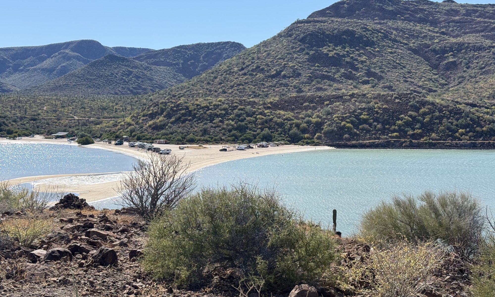
Here are some additional photos from the past two days. https://www.overlandadventureexcursions.com/photos-albums/nggallery/album/20250714-15-chicken-ak

20250713 – Frost Heaves and Dawson City

The day started for me with a 3-4 mile hike amongst the clouds of mosquitoes around the little lake where we were camped. It sure was quiet and beautiful out there, somewhere in the Yukon.

We got moving around 9 and stopped a few miles down the road to clear some DPF codes on the truck. I met a nice couple from British Columbia who were traveling in a Northern Lite Truck camper. We traded tips and some great conversation before heading back on the road. 15 minutes later I hit a bad frost heave at about 70 kph that was pretty bad. It bent one of my tie downs and pulled the tie down from the camper. Fortunately the repair that the previous owner made held, but I’m going to have to pull the aluminum siding up and fix it right this time.

We got into Dawson about 2, checked in to the El Dorado hotel, and then took the pups for a walk. Maggie darn near dove into the grass at the park to roll. Such a cutie. We put the pups into the camper and headed for some lunch. We ate at the first place we saw and enjoyed poutine and some chicken strips and fries. Food in Canada is $20-30 per plate here. Fortunately they pay regular wages so tips are not required (information provided to us by Canadians in Waterton Lake.

Kathy and I had a chance to do a bit of tourist shopping and sightseeing around town in the afternoon. We had a couple of beverages at a cool saloon called Bombay Bettys. The bar and room were decorated nice and the shaded patio was nice. We showered and freshened up in the hotel and relaxed in the room. Dawson is a cool old town to hang out in.

Here are some more pictures of the day. https://www.overlandadventureexcursions.com/photos-albums/nggallery/album/20250713-frost-heaves-and-dawson-city

20250712 – Teslin Lake to Somewhere

I got up early and studied the maps to try and figure out an itinerary up until we would be leaving AK. I think I’ve decided to skip the DempsterHighway and do the Dalton Highway. I’ve done the Dempster in 2019 and thought Kathy might like it, but the two are similar, and the PanAm highway traditionally starts in Deadhorse. If we skip it, it will help to get us back on budget, and free up some time to slow down. I’ll figure it out tomorrow since we will be in Dawson City, next to the Dempster.

I took the dogs for a walk and then made some breakfast before we headed out. Kathy and I slept well and were rested. We stopped in Whitehorse, the capitol of the Yukon province and fueled up. We also went into a Canadian Tire store to see what it was like. No food or lumber, but pretty much everything else. We picked up some snacks and supplies at the nearby Walmart and dollar store and continued north. We didn’t see and wildlife at all today, with the exception of ground squirrels and construction.

We stopped at another iOverlander suggested site about 2 hours south of Dawson City. The site is beautiful and quiet. It was raining when we stopped but has let up. It’s good as I wanted to walk the pups. We made hamburgers, mushrooms, and stuffing for dinner.

Tomorrow we have a hotel room to clean up and then we’ll explore Dawson and vicinity. Here are some more photos for the day. https://www.overlandadventureexcursions.com/photos-albums/nggallery/album/20250712-teslin-lake-to-somewhere

20250711 – Signpost Forest – Watson Lake

Since we left Dawson Creek we have ban driving on the Alaska Highway. We left Laird Hot Springs and drove a couple of miles out of the way, up a forest road to the top and next to some radio towers. A storm came in around 10PM and we slept to the sound of rain on the camper.

It was cold when we woke up, about 34 degrees. We made breakfast, packed up and worked our way down the mountain and then northward on the AK highway. We stopped for gas to ensure we made it to Watson lake, and so far this was the most expensive gas, 2.40 per liter. We only bought 10 gallons, which we probably didn’t need. But better to be safe.

While stopped there this guy asked if we were headed north and asked us if we’d take some gas up to a motorcycle rider that ran out of gas. Why not. On the way, we saw a bear eating something on the side of the road, so it delayed his gas by 10 minutes. We did find him at 45 miles up, just as the guy said we would. While waiting for him to refuel, I noticed there were strawberries all over the shoulder of the road. So we stayed and picked a 1/2 pint.

The next major stop was Watson Lake, which houses the Sig post Forest. It started in 1942 when an AK Highway worker put a sign up to bring home a bit closer. It had grown since. I put my license plate up in 2019 while on the trip with Carl Sevier, and after a bit of looking, I found it again. Kathy added her Dawson plate, signed and dated just above it. If you are there and see us, reach out and say hello.

The rest of the day was driving in the rain and we made it to Teslin Lake around 5. We made camp at an IOverlander suggested spot on the edge of the lake with stunning views of Teslin lake. It started raining again and we slept soundly.

here are some more of the days photos. https://www.overlandadventureexcursions.com/photos-albums/nggallery/album/20250711-watson-lake-and-teslin

20250710 – The Road to Laird Hot Springs

We drove the 255 miles today to Laird Hot Springs through some more forests and then some breathtaking mountains. The day was filled with wildlife. First a moose and her calf, then a Canadian Lynx, then some Big Horn sheep and their kids, and a herd of buffalo and their calves, and two bears wrestling along the road, and finally some cute squirrels. The 5 hour drive was beautiful.

Laird Hot Springs campground was full and we had the option to pay for a spot in the overflow lot. Nope, just paid to use the hot springs, then used their picnic area to bbq some chops and potatoes for dinner. We used iOverlander to find a spot, but the past few days the trees and lack of cell service hindered calls, etc. So we found a top of the mountain spot with amazing views.

Here are some more photos from the day. https://www.overlandadventureexcursions.com/photos-albums/nggallery/album/20250710-to-laird-hot-springs

20250709 – Dawson Creek to Airfield.

We left Oscar at the vet to be cremated and will be back to pick his ashes on the way back down. We had planned two nights in Grande Prairie but after saying goodbye, we fueled up, filled the fridge, and headed to Dawson Creek to Mile 0 of the Alaskan Highway to start the next section fresh.

We took the tourist pictures, walked the pups around downtown, and then visited the museum. We found a nice R.V. park just outside of town and got the planned laundry done and headed to bed early. Neither of us had much sleep last night.

The night was rainy and windy but Howie was quiet and warm. We headed out first thing in the morning up the Alaskan Highway. The highway to Fairbanks is 1525 miles. The route we are taking is 1200 miles to Dawson City. So it’s not a quick run, considering the top speed is 100KPH (62mph). We are doing 200-300 mile chunks. Today we headed to hit Prophet River Wayside Park, about 225 miles.

There is a whole lot of forest on this highway as well as some recent forest fires. One from last year was massive and took out an entire valley for 30 miles. Pretty sad.

We arrived around 4 and made camp. There was a family from Mexico camping there with a YouTube link so I looked them up. They were live broadcasting. At the time so I sent them a note we were camped next to them and would say hello. David and Ixchel are Mi Casita Nomada and they have been traveling since 2023. I talked to them for about 20 minutes and we wished them well. We may run in to them again.

Some other campers at this site were dressed up in some strange outfits and hanging from a board between trees, so I had to ask. The group were training for skydiving and extricating themselves from trees. They were getting on a plane in the morning and skydiving into a remote river location and then rafting down the river.

We later took the pups for a walk and relaxed for the evening. I found some raspberries and wild strawberries near the Prophet River. We miss Oscar and both went to sleep around 9 and slept a full 11 hours. Tomorrow is Liard Hot Springs.

Here are some more photos of the day. https://www.overlandadventureexcursions.com/photos-albums/nggallery/album/20250709-dawson-creek

20250708 – Oscar, A Sad Goodbye.

This is a sad post to write. This morning, July 8, 2025 at 11:18 AM local time Kathy, Maggie, Zuzu and I bid farewell to our travel buddy, Oscar.

Oscar was born in November of 2011 in Queen Creek, AZ and I picked him up at the end of December to his new home. Oscar and I bonded immediately and he hung out in my FJ while I was at work. Oscar’s trademark was riding on the dash of the FJ, a love for him that started when he was a pup just to keep him from crawling under the seats.

Oscar grew fast and soon moved to Colorado with me and my former spouse and spent the next 7 years traveling on my dash throughout the Rocky Mountains and Midwest. He never disliked the cold up there and enjoyed the streams and forests as well. He always loved riding, road-tripping, camping, or just a quick trip to the store (on the dash, of course).

In 2019 he moved with us back to Arizona and set up shop in Mesa. He loved walks, burying bones in the sand, and just hanging out with his people (really anyone). He moved again in 2022 to Coolidge after my spouse and I divorced and quickly enjoyed the construction area that eventually became his back yard.

The past several years he transformed into a lovable old man that enjoyed meeting everyone, being in spaces with people, going on morning and evening walks, endless treats at the grandparents house, and always wanting up on the FJ dash on trips to the store.

Oscar set out on this PanAmerican Highway trip with us on June 2 and was having a great time at every stop, meeting people, exploring the more than 25 parks, and of course the smells, always bopping along. After enjoying a couple of great nights in Jasper NP where he curled up next to us at the fire, wandered the campground, we headed toward Grande Prarie, Alberta, Canada. Oscar’s last stop.

We arrived in Grande Prairie around 7pm and let the pups out for their bathroom break and Oscar had some blood in his stool. We were concerned, but back in the room he ate and drank normally. But he declined a walk. The night was a long one for him. In the morning we took him to a vet who drew blood samples, gave him an IV, and we found out his body was shutting down. The vet was incredible with him He passed just before lunch. He was 13 years 9 months and lived a great life

It is a sad day for us. We love you and miss you already. We’ll see you on the other side. Here are some great photos and memories of our little man. https://www.overlandadventureexcursions.com/photos-albums/nggallery/album/20250708-a-sad-goodbye

Saying goodbye to a good old friend and adventurer.

20250706-07 Jasper National Park

We spent two nights at Willcox campground. The second day we visited the Alabaster Glacier and the very busy visitors center. We enjoyed two nights of campfires, hanging out, walking the dogs, and just being in the forest.

On the 7th we checked out and did a long day of driving into Jasper and then on to Grande Prairie. Along the way we got to see some great waterfalls, an Elk merging through traffic, a herd of mountain goats, and a moose. We stopped in Hinton to fuel up, feed the pups, and have lunch, and then we took the scenic drive north.

We had planned to stay two nights in a hotel in Grand Prairie to be able to clean up and get some laundry done. So far the trip has been great, but Grande Prairie would be a place we’ll always sadly remember.

Here are some more photos from today. https://www.overlandadventureexcursions.com/photos-albums/nggallery/album/20250706-07-jasper-to-grande-prairie